Resources Overview
- About Colebrook
- Sandybrook Management Plan
- Colebrook's Notable Trees
- Trees, Shrubs & Plants at Rock School
- Environmental Education
- For Hikers
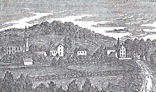
Welcome to Colebrook, Connecticut

The last town in colonial Connecticut to be settled,Colebrook was named after a town in Devonshire, England. The reason is presently unknown. The year 1765 saw Benjamin Horton, leader of a trickle of settlers, arrive amid virgin forests. Samuel Rockwell, among those who shortly followed two years afterward, built one of the outpost’s first houses. Here before long was born Colebrook’s first child, a boy fittingly named Alpha Rockwell.
Iron forges soon developed, ore being drawn by oxen from Salisbury for smelting with the plentiful local hardwood. Cannon for use in the Revolution were made and lugged where needed. A story connects one of those with the piece on exhibit in Quebec whose label states “Taken by the British at Bunker Hill.”
GeographyAccording to the United States Census Bureau, the town has a total area of 85.3 km (32.9 mi). 81.5 km² (31.5 mi) of it is land and 3.8 km (1.5 mi) of it (4.40%) is water. The Algonquin State Forest is located within the town. |
||
Principal Communities► Colebrook Center ► North Colebrook ► Robertsville
|
||
Demographics
|
||

Algonquin State Forest
Sandy Brook Road | Colebrook, CT | Sept. 2011
Prepared For: Connecticut Department of Energy and Environmental Protection
Author: Harry White, Ecologist ~ Colebrook, Connecticut
Funded by the Grant Program of the Farmington River Coordinating Committee
The Sandy Brook Natural Area Preserve, lying astride the Northwest Highlands and the Northwest Uplands Ecoregions, consists of those portions of Sandy Brook and the adjacent uplands of the Algonquin State Forest and the Kitchel Wilderness lying within 100 feet of Sandy Brook in the town of Colebrook, Connecticut. The uplands, encompassing 43 acres, protect the adjacent salmon and native brook trout fishery, create a scenic corridor, and provide habitat and a migration corridor for upland wildlife. Sandy Brook is considered the highest-ranking Atlantic salmon restoration stream in the Farmington River Basin.
Section 23-5a of the Connecticut General Statutes (CGS) establishes a state system of Natural Area Preserves to preserve the natural attributes of scenic, high-value wilderness areas. To become part of the Natural Area Preserve System, a site must include land or water containing or potentially containing plant or animal life or features of outstanding biological, scientific, educational, geological, paleontological, or scenic value worthy of preservation in their natural condition. In 2002, Governor John Rowland designated the Sandy Brook Natural Area Preserve (NAP). The NAP designation requires a detailed management plan to protect the preserve’s unique species, communities, and other attributes.
View/Download/Print the Entire Document >>
Colebrook’s Notable Trees

Legendary frontiersman Johnny “Appleseed” Chapman probably said it best:
“Nothing gives more yet asks less in return than a tree.”
In Colebrook, trees contribute to our town’s rural beauty. They offer places for relaxation and recreation. They provide food and shelter for wildlife. They improve our air and water quality, save on energy costs, and help reduce global warming.
With the goal of bringing attention to the importance of trees to our everyday life, the Colebrook Land Conservancy set out, with your help, to identify our town’s special trees. We thank those who participated in our survey and the State of Connecticut’s Department of Environmental Protection that helped make this project possible with an America the Beautiful grant.
Here’s the report of our findings >>
List of trees, shrubs & plants found at the Rock School yard
 The Rock Schoolhouse was continuously used from 1779 until 1911.
Throughout this paper, compass points are used as references. Colebrook Road (Route 183) is on the west side; Sandy Brook Road is on the south side; the long stone wall defines the east side and the chimney of the school is on the north.

Lorem ipsum dolor sit amet, consectetuer adipiscing elit. Aenean commodo ligula eget dolor. Aenean massa. Cum sociis natoque penatibus et magnis dis parturient montes, nascetur ridiculus mus. Donec quam felis, ultricies nec, pellentesque eu, pretium quis, sem. Nulla consequat massa quis enim. Donec pede justo, fringilla vel, aliquet nec, vulputate eget, arcu. In enim justo, rhoncus ut, imperdiet a, venenatis vitae, justo. Nullam dictum felis eu pede mollis pretium. Integer tincidunt. Cras dapibus. Vivamus elementum semper nisi. Aenean vulputate eleifend tellus. Aenean leo ligula, porttitor eu, consequat vitae, eleifend ac, enim. Aliquam lorem ante, dapibus in, viverra quis, feugiat a, tellus. Phasellus viverra nulla ut metus varius laoreet. Quisque rutrum. More >>
 Hale Trail Map
About a mile long, the Hale Trail provides an opportunity to explore a wooded area which was a part of a farm dating back to the 1700’s. Over the centuries, this land was extensively grazed, farmed, and logged. Few native shrubs, ferns, or wildflowers grow beneath the shade of the hemlocks and large white pines.
The trail has been created by, and the property preserved by, the Colebrook Land Conservancy. Refer to the printed trail guides provided at the trailhead for more information and enjoy a walk through a bit of New England history.
That walk might also reward you with sightings of some of New England’s more secluded inhabitants; from pileated woodpeckers to porcupines; from red-tail hawks to red efts!
(Average Terrain, Flat Contour, Good for Kids, Medium Difficulty, Rural Area, Scenic Surroundings).
The Colebrook Land Conservancy
Post Office Box 90
Colebrook, Connecticut 06021
info@colebrooklandconservancy.org

Our Mission
Preserve and conserve the special and unique characteristics of Colebrook—rural, historic and scenic—using accepted land conservation techniques and education in cooperation with the Town, the community and other groups.