Hikers Welcome!
The Hale, Rockwell, Deer Hill & Sandy Brook Trails right here in Colebrook await your exploration. Join our email list to watch for notice of guided hikes, offered periodically, where you’ll learn about trees, wildlife, vegetation and local ecosystems.
Come Take a Hike on The Colebrook Land Conservancy’s Scenic Trails
Sandy Brook Trail
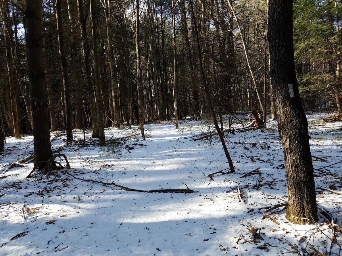
Located on the Colebrook Land Conservancy’s Sandy Brook Forest Preserve in North Colebrook, the Sandy Brook Trail is a 1.5 mile long loop trail where elevation rises from about 1050 feet to about 1150 feet. The trail is categorized as a medium level of difficulty. Trail guides are available at the trailhead, which is on Beech Hill Road on the left just after the bridge when you turn from Sandy Brook Road. Park in the grassy area off the road.
The Sandy Brook Forest Preserve is part of a large protected wilderness corridor that includes the Algonquin State Forest, the Phelps Research Area, and Aton Forest. Sandy Brook and North Brook, also known as Viets Brook, are the main stream systems in the Preserve and partly border the trail. The Sandy Brook watershed is one of the major hydrologic basins in the West Branch of the Farmington River, a National Wild and Scenic River. Sandy Brook is an outstanding mountain stream in a dramatic setting with steep slopes, cascading feeder streams, spectacular wildlife, pocket wetlands, and a three-mile run through one of the largest state forests.


The Preserve is dominated by eastern hemlock, oak, black cherry, maple, birch, hickory, and white ash in a mosaic of distributions. American beech, poplar, and eastern white pine are found here as well. Dark-gray and rusty mica schist and gneiss bedrock (800-1700 million years old) is evident across the property in the form of glacial detritus that includes many large and small boulders, small outcrops, and ledge exposures.

")
The Deer Hill Trail

The Deer Hill Trail features both a 1.3 mile loop trail and a .6 mile spur trail that gradually climbs to the northwest summit of the property. A roadside parking area at the trailhead is .3 mile up from Route 8 on the north side of Deer Hill Road.
Along the loop trail you’ll see such natural features as a huge 36” diameter oak tree, several springs, a walk along a pine forest ridge overlooking a winding ravine, and many varieties of tree and plant life, all thanks to the trail’s diverse elevations and soil types. The trail also takes you past historical charcoal pits. Climbing the spur trail will reward you with spectacular views to the east as you walk north along the side of the slope, and you’ll cross a trickling stream as you make your descent. Both trails are categorized as Medium to Difficult.


The Hale Trail

In every walk with Nature one receives far more than he seeks.

About a mile long, the Hale Trail provides an opportunity to explore a wooded area which was a part of a farm dating back to the 1700’s. Over the centuries, this land was extensively grazed, farmed, and logged. The trail crosses several wet areas and a small brook. This area of town has a number of springs.
The trail has been created by, and the property preserved by, the Colebrook Land Conservancy. Refer to the printed trail guides provided at the trailhead for more information and enjoy a walk through a bit of New England history.
That walk might also reward you with sightings of some of New England’s more secluded inhabitants: from pileated woodpeckers to porcupines; from red-tail hawks to red efts!
(Average Terrain, Flat Contour, Good for Kids, Medium Difficulty, Rural Area, Scenic Surroundings).
The Hale Barn is a vanishing breed of 18th century barns that once graced much of the Connecticut countryside. Today it is owned by the Colebrook Land Conservancy and is protected along with 38 acres upon which it sits. During its most recent past it was one of Colebrook’s last working dairy farms owned and operated by the Hale family. The Conservancy also acquired 4 acres diagonally across the road and they too are preserved as open space.
The historic crossroads of Stillman Hill Road and Rte 183 where the barn stands date from the 1760s when Stillman Hill Road was built as a segment of the Old North Road for the movement of military troops during the French and Indian War. Later, during the Revolutionary War following the British defeat at Saratoga in October 1777, British and Hessian prisoners were marched south through Colebrook along this very road.
Today this land has significant natural value as it features a diverse landscape of fields, wetlands and forest types lying in the Loon Brook watershed. It also provides a variety of habitat for wildlife, such as deer, porcupines, great horned owls, ravens, ruffed grouse, wild turkeys, Eastern meadowlarks, bobolinks, and amphibians and reptiles.
A loop trail is located on the northern section of the property. The trail head can be found approximately 200 yards north from the sign in front of the barn, at an opening in the guard rail on the left side of Route 183 as you travel toward Colebrook Center. It is recommended that you park at the flat area by the barn and walk to the trail head. Please be watchful of oncoming traffic.
Conservation of this open space was made possible by the generosity of the people of Colebrook, friends and members of the Colebrook Land Conservancy and a grant from the State of Connecticut.
The Rockwell Trail

I have never taken a walk in the woods and been disappointed.

The Rockwell Trail, though slightly less than a half mile long and easy to hike, provides rewards that you might expect from a much longer trail. This land has been used for only three purposes since the 1760s: harvesting trees for making charcoal and timber for lumber, stone quarrying and sheep raising. The last time it was lumbered was in the 1980s (timber will never be cut here again); the larger pieces of slash (woody debris) from this operation are still evident. The small trees that are trying to regenerate as a result of this timber cutting are a good example of an intermediate forest. In a few years most of them will have died as a result of aggressive competition for the limited amount of sunlight. When a more mature forest is established much of the underbrush and small branches that litter the ground will be gone, resulting in easier walking and better views.
After the first 100 yards, the trail splits, and forms a loop. Bear right at the split, and the first point of interest is a large white pine at the top of a small rise. This pine survived timbering because it does not contain a straight trunk, thereby yielding a small amount of usable timber in relation to the effort required to harvest it. Lumbermen refer to such trees as “wolf trees”; in this case a “wolf pine.”

A few feet behind the wolf pine, a cliff becomes visible off to the right that will continue for the next two or three hundred yards. This is the area that was quarried during the late eighteenth and early nineteenth centuries.

You can still see evidence of this operation a little further along the trail that now bends to the right in the form of a rock that defied the best efforts of the quarrier to split it in half. The weathered metal objects you can see embedded in the stone are called plug and feathers; two tapered pins (feathers) are inserted into a hole drilled in the stone and the plug is pounded between them, causing the pressure to split the stone. If the quarry man miscalculated the grain of the stone, he was unable to split the stone and the feathers and plugs remained stuck inside, as seen here.

As you gaze down upon the massive boulders at the base of the escarpment, note that some of them are covered with a short, dark-leaved fern named Common Polypody. These ferns don’t like competition, and often blanket rock surfaces spurned by other vegetation.
There are two things to be observed about the Beech trees that are prevalent around you. Some have smooth gray bark. These are healthy specimens; the ones having bark with deep striations are dying with a disease that is killing off the Beeches just as the Chestnut blight has eliminated the American Chestnut. The other point of interest is the deep scaring around the base of several Beech trees, which was caused by Porcupines eating the bark and often results in the death of a tree if the bark is removed all the way around.
The land descends from here, and as it levels off you will see a broken tree trunk with small hemlocks growing from its upper surface. One end is five feet above the ground and looks very much like a camel’s head. As the trail passes near the left of the broken tree, close observation will reveal a virtual miniature garden of plants and mosses growing on its upper side. Several more yards bring you to a large boulder on the left side of the trail. The flat surface facing you is the result of quarrying (note the drill holes).

Shortly before rejoining the main trail, notice the stand of Striped Maples, most of which are on your left. Some of these have a circumference of two feet – giants of their species. The largest specimen in the state grows in White Memorial Reserve in Litchfield and has a girth of about 30 inches.
The Colebrook Land Conservancy asks you to please be careful when stepping over the several moss-covered logs that have been left across the trail. Close inspection reveals them to be covered with very delicate and beautiful plant life.
The majority of trees that will be encountered along this trail include Ironwood, Rock Maple, Red Maple, Striped Maple, White Pine, Hemlock, Beech, Black Cherry, White Birch, Yellow Birch, Black Birch, Red Oak, White Ash and Basswood (you may find others).
Depending upon the season, some of the flowering plants along the trail are Trillium, Wintergreen, Indian Pipe, Sorrel, Gill-over-the-ground, Red Clover, White Baneberry (doll’s eye), Lamb’s Quarters and many varieties of mushrooms.
Check out the printed trail guides in a box at the trailhead for additional historical and botanical information.
Trails Map

Additional Trails in Northwest CT & Southwest MA
Links to Local Trails Info
- Housatonic Flats Reserve – Great Barrington, MA
- Monument Mountain – Great Barrington, MA
- Rand’s View Out and Back, Canaan, CT
- White Memorial Conservation Center
- York Lake, Sandisfield State Forest, Sandisfield, MA
More Local Trails
- 1000 Acre Swamp: New Marlborough, MA
- Kent Falls Trail: Kent, CT
- Tunxis Trail: Burlington/New Hartford/Barkhamsted/Hartland, CT
- Peoples Forest Trail Network: Barkhamsted, CT
- Heublein Tower Trail: Simsbury/Avon, CT
- Metacomet Trail: Simsbury, CT
- Rail Trail: Winsted/Torrington, CT
- Rail Trail: Farmington, Canton, Avon, Simsbury, Granby, CT
- Undermountain Trail: Salisbury, CT
- Appalachian Trail: Salisbury, CT
- Appalachian Trail: Cornwall, CT
- Appalachian Trail: Great Barrington, MA
- Falls Brook Trail: Hartland, CT
- Ordway Trail: Granville State Forest, MA
- John Muir Trail: Burr Pond State Park, Torrington, CT
The Colebrook Land Conservancy
Post Office Box 90
Colebrook, Connecticut 06021
info@colebrooklandconservancy.org

Our Mission
Preserve and conserve the special and unique characteristics of Colebrook—rural, historic and scenic—using accepted land conservation techniques and education in cooperation with the Town, the community and other groups.